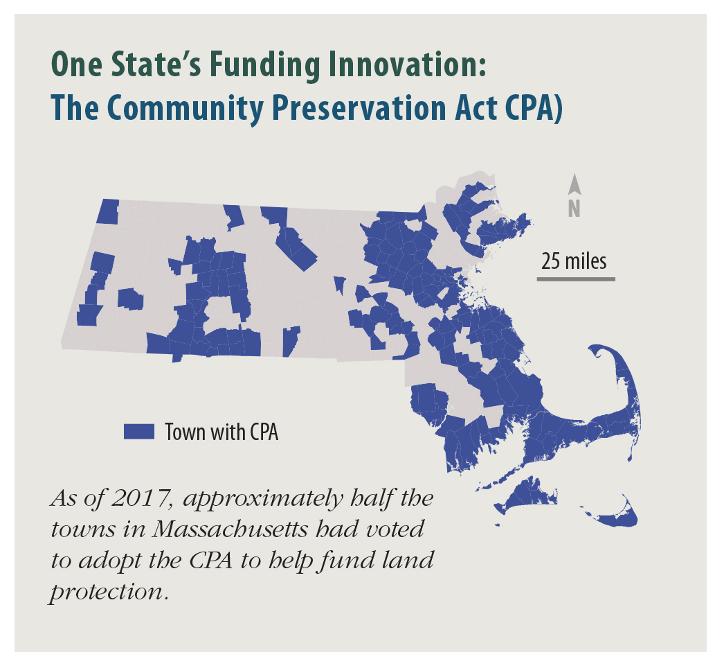
Figure 18 from 2017 W&W Report. Data from:
MassGIS. 2016. Community Preservation Act (CPA) Towns. Office of Geographic Information (MassGIS), Commonwealth of Massachusetts, MassIT.
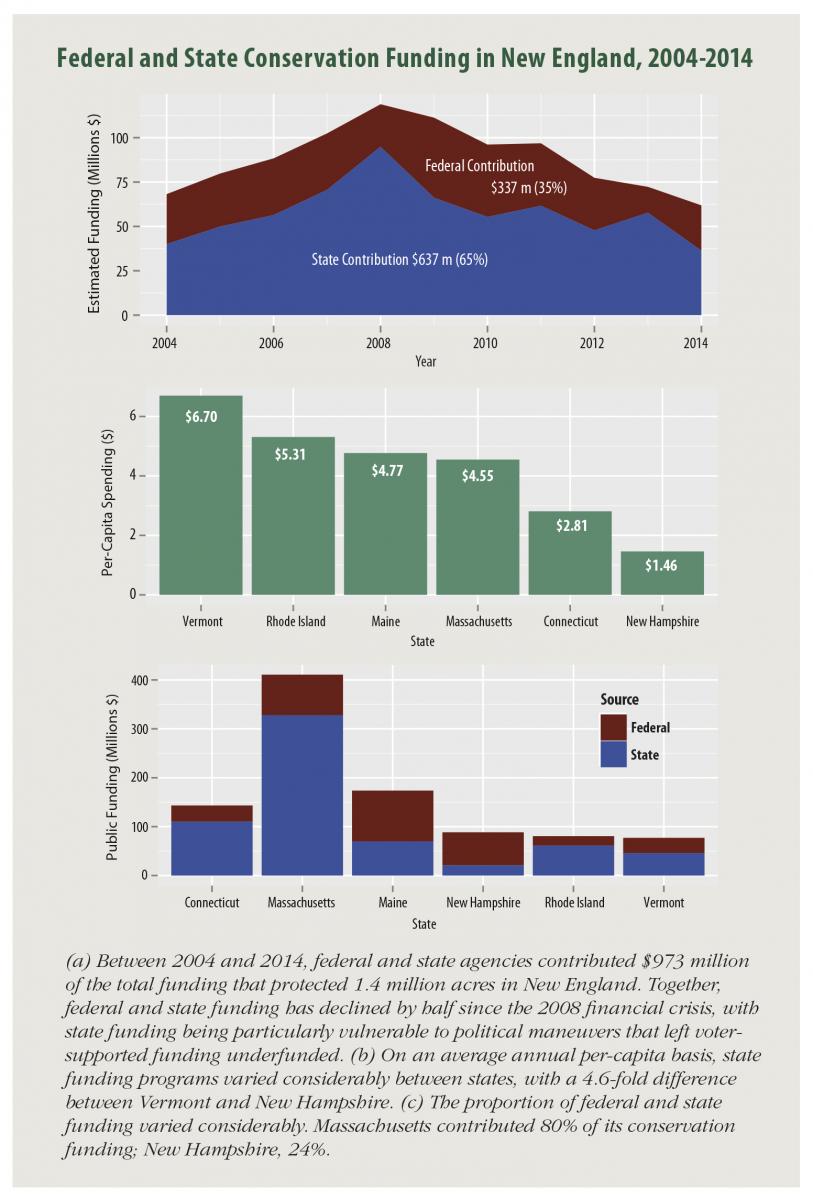
Figure 14 from 2017 W&W Report. Data primarily from Highstead and the Trust for Public Land. Complete references available in M. Buchanan. 2016. Public conservation funding in New England: recent trends in government spending on land protection. Highstead, Redding, CT.
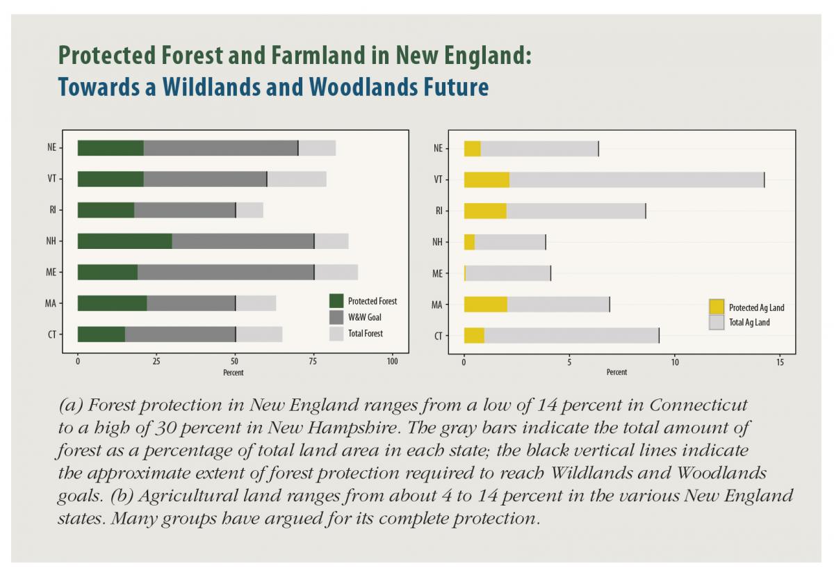
Figure 13 from 2017 W&W Report. Forest cover data from Olofsson et al. 2016 and Homer et al. 2015 (see cited refs #7 and 8). See Thompson et al. In Review (cited ref #19) for methods. Conservation data from USGS 2016 (cited ref #26). Full figure references available in the full report.
